Showing posts with label geography. Show all posts

Thursday, October 4, 2018

Greyhawk Underdark Updated

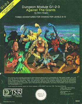
It's been quite a while since I posted my updates to, at that time FtF campaign, delve into the Underdark. My online Roll20 campaign is now half way through the Giants series, and so it was time to re-visit those maps.
I had originally re-done Denis' Encyclopedia Subterranica maps at that time, but I'm still not completely 100% happy with it. Since the original module is already in the old-school blue, and the other scans I have of the Underdark maps from the various Into the Depths modules aren't quite high enough resolution for the online game, I did the next best thing. Now any normal/sane person would have just fired up their scanner and used any of the many modules he owns of this product to get a better, higher resolution image, but noooo, not this guy. Fired up the imaging software instead and went in and redid the map in a closer adaptation of the original maps found in the published works. Don't get me wrong, I liked the others maps out there, just had to make one I was satisfied with.


Here are the results from that little side trip into OCD-land. While it's doubtful the time spent resulted in any great contribution to this already overdone [and some cases better done] map, it nevertheless made me happy about the results achieved. Now to get on with the all the battlemaps for all those many encounters listed on the map. [heavy sigh]


Edit; Since things can always be tweaked now that there is a template to work from, changed out the b&w for colored passages on the map.


Since I already had the hand drawn maps from the Trading Grounds done went ahead and did that first. These are only for my personal online game on Roll20 and meant as an example of my hack job at putting together maps.


This from the original below

Friday, June 29, 2018

Medieval Trade Routes

From Martin Jan Månsson, a graduate student in Spatial Planning at the Blekinge Institute of Technology, Sweden. Not studying cartography nor history, Månsson has produced this very detailed map of trading routes during the Middle Ages. (You can download the map in high resolution here.)

I can only assume that instead of working on his dissertation he found this to be much more fascinating. Can't really say I blame him.

“I think trade routes and topography explains world history in the most concise way,” Månsson explains in the very small print at the map’s lower right corner. “By simply studying the map, one can understand why some areas were especially important--and remained successful even up to modern times.”

The map covers some 200 years, spanning both 11th and 12th centuries, and “depicts the main trading arteries of the high Middle Ages, just after the decline of the Vikings and before the rise of the Mongols, the Hansa and well before the Portuguese rounded the Cape of Good Hope.”

It also shows the complex routes already available to Africa and Asia, and the areas where Muslim and Christian traders would meet. The open-to-trade Song Dynasty ruled China, and the competitive kingdoms in the Indonesia region provided both Muslims and Europeans with spice.

Looking like a railway map, Månsson’s work shows how interconnected we really were back in the Middle Ages, from Greenland in the west to Kikai and Kagoshima in the East, from Arkhangelsk in the frozen north to Sofala in modern-day Mozambique.

Månsson credits Wikipedia for a majority of the basic work, but also lists 20 other sources for this detailed work, including The Silk Road by Valerie Hanson, Across Africa and Arabia by Irene M. Franck and David M. Brownstone.

Friday, June 30, 2017

All the Rivers & Streams in the U.S. Shown in Rainbow Colors

A data visualization to behold


A beautifully rendered multi-color map. Created by Hungarian geographer and map-designer Robert Szucs, using open-source QGIS software, the high resolution map above shows:
all the permanent and temporary streams and rivers of the contiguous 48 states in beautiful rainbow colours, divided into catchment areas. It shows Strahler Stream Order Classification. The higher the stream order, the thicker the line.

When you look at the map, you'll see, as The Washington Post observes,
 "Every river in a color drains to the same river, which then drains into the ocean. The giant basin in the middle of the country is the Mississippi River basin. Major rivers like the Ohio and the Missouri drain into the behemoth."
Pretty cool.
Imugr gallery of originals.

Friday, February 17, 2017

Japanese Designers May Have Created the Most Accurate Map of Our World


This is from over on OpenCulture
Instead of abstracting the globe into a cylinder, then a plane, as the Mercator Projection did, the AuthaGraph turns the earth into a tetrahedron, which then unfolds in any number of ways, as you can see further up, and “can be tessellated just like an MC Escher painting… much in the same way that we can traverse the planet without ever coming to an end.” Rather than one focal point—the North Atlantic in Mercator’s case—nearly any place around the earth can be at the center. Versions of the map are already being used in Japanese textbooks.
The video above from Ponder explains the AuthaGraph design, which is not—and could never be—100% mathematically accurate, but can, Narukawa writes, with “a further step” in its subdivisions “be officially called an equal-area map.” The concept was important to him because of the urgent relevance of globalist thinking. As he points out, writes Japanese design blog Spoon & Tamago, “A large bulk of the 20th century was dominated by an emphasis on East and West relations. But with issues like climate change, melting glaciers in Greenland and territorial sea claims, it’s time we establish a new view of the world.” Those in the centers of Eastern and Western power ignore the rest of the world at everyone’s peril. It may help to have a much more equitable way to visualize our shared planet.


See full article here.

Tuesday, December 6, 2016

Why Making Accurate World Maps Is Mathematically Impossible


Jorge Luis Borges once wrote of an empire wherein “the Art of Cartography attained such Perfection that the map of a single Province occupied the entirety of a City, and the map of the Empire, the entirety of a Province.” Still unsatisfied, “the Cartographers Guilds struck a Map of the Empire whose size was that of the Empire, and which coincided point for point with it.” But posterity, when they lost their ancestors’ obsession for cartography, judged “that vast Map was Useless, and not without some Pitilessness was it, that they delivered it up to the Inclemencies of Sun and Winters.” With that enormous map, in all its singular accuracy, cast out, smaller, imperfect ones presumably won the day again.

With that well-known story “On Exactitude in Science,” Borges illustrated the idea that all maps are wrong by imagining the preposterousness of a truly correct one. The Vox video “Why All World Maps Are Wrong” covers some of the same territory, as it were, first illustrating that idea by slitting open an inflatable globe and trying, futilely, to get the resulting plastic mess to lie flat.

“That right there is the eternal dilemma of mapmakers,” says the host in voiceover as the struggle continues onscreen. “The surface of a sphere cannot be represented as a plane without some form of distortion.” As a result, all of humanity’s paper maps of the world–which in the task of turning the surface of a sphere into a flat plane need to use a technique called “projection”–distort geographical reality by definition.

The Mercator projection has, since its invention by sixteenth-century Flemish cartographer Gerardus Mercator, produced the most widely-seen world maps. (If you grew up in America, you almost certainly spent a lot of time staring at Mercator maps in the classroom.) But we hardly live under the limitations of his day, nor those of the 1940s when Borges imagined his land-sized map. In our 21st century, the satellite-based Global Positioning System has “wiped out the need for paper maps as a means of navigating both the sea and the sky,” but even so, “most web mapping tools, like Google Maps, use the Mercator” due to its “ability to preserve shape and angles,” which “makes close-up views of cities more accurate.”

On the scale of a City, in more Borgesian words — and probably on the scale of a Province and even the Empire — Mercator projection still works just fine. “But the fact remains that there’s no right projection. Cartographers and mathematicians have created a huge library of available projections, each with a new perspective on the planet, and each useful for a different task.” You can compare and contrast a few of them for yourself here, or take a closer look of some of the Mercator projection’s size distortions (making Greenland, for example, look as big as the whole of Africa) here. These challenges and others have kept the Disciplines of Geography, unlike in Borges’ world, busy even today.

Saturday, July 16, 2016

New Campaign - B2 Keep on the Borderlands

A while back I was playing an AD&D 1ed game online set in Greyhawk. My favorite game and setting, in case that isn't obvious yet. Unfortunately that game dissolved after a short while along with a couple other online games I had been playing in. After a short stint looking for something suitable I decided to bite the bullet and just DM it myself. This was in part because the FtF campaign I've been DMing is starting to wind down after ~7 years of play.

So now I'm DMing a Google Hangouts game starting off in the Keep. Naturally I've set it in Greyhawk and will be taking the folks through B2 Keep on the Borderlands to start off. Believe it or not, except for a short foray into the Caves of Chaos just recently, I had never played or DMed this module.
Looking around on the web there is a metric ton of info, game reports, maps, conversions and the like for this module. So naturally I decided to add some more junk to the pile. If someone finds it useful, great, but really I'm just putting it up here as a sort of work in progress, for my own benefit primarily.

My first steps in setting up any new campaign is, and has always been, the maps. Looking around for maps of the wilderness and Keep I found a few that I liked but just weren't 'perfect', for me anyways. So, naturally I took the ones I liked and adjusted them to suit my own tastes and style.

The Hexographer map over on breeyark.org was the closest to what I had in mind, so that's the one I adjusted to my liking.
As you can see I've borrowed things from all over the place on this map.
The scale 'debate' I just sidestepped by making the caves ~2.5 hours to get to by an unencumbered man on foot and left it at that. You'll notice some farmhouses and fields located just outside the Keep. These I placed there because it seemed like a perfect place for the start of a new town, with some protection nearby. The farmers scamper into the Keep at nightfall when the raiding gets to be extreme. After all, they're brave not stupid.


Since this is situated in Greyhawk the next question was where was I going to place it, besides the suggested Yeomanry.
Since I'm planning on tying this in with The Temple of Elemental Evil later I decided to place it not too far away on the Wild Coast along the Jewel River. If you click on the environs map you'll see a spot towards the bottom in the middle of the Welkwood labelled Baridel Castle, the name for the Keep I adopted in my version of Greyhawk.


The next step was the keep itself. The Castellan Keep map over at halfblogre.com caught my eye, so that was the next to get incorporated into my milieu. As you can see I just adjusted it slightly to conform to my view of the Keep. You'll notice I've added some storage towers to the inner gatehouse, as well as switching the location of the stables and warehouse. I just figured the Smith would need direct access to the horses and putting it next to the Smithy/Armorer would make more sense. You'll also note that I added some barracks to the inner bailey since the 250+ inhabitants (mostly soldiers) of this castle needed someplace to sleep, too.

Next time is some old school blue maps of the different buildings inside the Keep itself.

Thursday, February 11, 2016

Underdark Caves and Underground Rivers

While perusing the internet doing research for my campaign which recently went into the Underdark I ran across these interesting articles. They were helpful in getting into the right headspace while laying out the upcoming sessions.

via Collossal
A Trip by Air and Kayak Through Tham Khoun Xe, One of the Largest Active River Caves on Earth by Christopher Jobson on February 10, 2016


All photos © Ryan Deboodt Photography
Beijing-based photographer Ryan Deboodt (previously) recently returned from a trip to Laos where he spent two days exploring Tham Khoun Xe, one of the largest active rivers caves in the world. Stretching nearly 4.5 miles (7km) underground, the cave system is extraordinarily remote and Deboodt was permitted to photograph and film beyond where tourists are normally allowed to visit. The immensity of the subterranean space is staggering, with an average ceiling of almost 200 feet (60m) and width of 250 feet (76m) it’s hardly imaginable a space like this could exist underground.
Deboodt brought an arsenal of camera and video equipment as well as a drone to capture the expansive interiors of Tham Khoun Xe, much of which he edited into a short video included below. You can follow more of his cave photography from around the world on Facebook or Instagram, and read an interview about the endeavor on Smithsonian.


via Colossal
An Aerial Tour of ‘Hang Son Soong,’ the Largest Cave on Earthby Christopher Jobson on March 13, 2015


In his new 6-minute film, cave, adventure, and travel photographer Ryan Deboodt takes us on a breathtaking aerial tour of the world’s largest cave, Hang Son Doong, located in central Vietnam. Deboodt brought a drone and an array of cameras to help capture the cave system, the largest chamber of which is 5 kilometres (3.1 mi) long, 200 meters (660 ft) high and 150 meters (490 ft) wide. Despite its enormity, the cave was only discovered in 1991 by a local man, and it wasn’t even studied by scientists until about five years ago. One of the most disorienting thing about watching Deboodt’s film was my brain not comprehending the scale of what I was looking at. It’s only once you notice the ant-like people walking through some of the shots that you realize just how massive this place is. You can see more of Deboodt’s cave photography on Instagram. (via PetaPixel)

Sunday, January 31, 2016

Underdark Map - Trading Grounds

Since the last Underdark update the party has been exploring the lower third of the map. Actually more accurately party B has been exploring the Underdark while party A has been travelling the surface world clearing the Gray Plague from the land. Most of the player's had 2 PCs for a while there and since they're getting pretty high level [in the low to mid-teens] the group decided to split the party into Group A and Group B so that they weren't waltzing so easily through encounters and also partially to avoid having to split up XP so many ways.

As mentioned in my previous post I've been using much of the material from the Dragonsfoot Collaborative Project: Mapping the Depths of the Earth. As happens much of the time the players decided to go where you haven't prepared fully ahead of time. Wouldn't you know it the party decided to go to the trading grounds [L/19 M/19 on the Underdark map] which has no associated map. So I put together a quick map from the description for the PCs on the spot. This is the PC version only, the DM version has the manor and the rest at the bottom of the map behind the locked gate. I edited that portion out because the players do look at the blog posts occasionally. This way they're not tempted to look at what they haven't seen/explored yet. I'm finding the whole Encyclopedia Subterranica from this project to be of tremendous help and a great time saver in getting the various locations fleshed out for exploration. I would recommend it highly for anyone running the D series modules or any other Underdark adventure.

Thursday, August 20, 2015

Regional Alignments in Greyhawk

Since I've already done the regional trade resources map in Greyhawk, a regional alignment map only seems like a logical extension to that. Here it is;

Greyhawk Regional Alignment

Tuesday, July 7, 2015

Greyhawk Underdark Update

Well the PCs have finally made it through the "Against the Giants" series of modules


and are proceeding into the


"Descent Into the Depths of the Earth" portion of the whole GDQ series. Now, while I own the original modules, I still like using printed out maps in game, usually as covers in the 3-ring binders I have all my DM notes in. While the maps provided in the modules D1-2 and GDQ 1-7 are all good, I ran across Maldins Greyhawk pages a long while back and he has a color map he re-did for the Dragonsfoot Collaborative Project: Mapping the Depths of the Earth. While I like his map the distinction between the tertiary tunnels and the hidden tunnels are hard to distinguish (for my old eyes anyway). See for yourself.

 
Maldin's original page and map


That's why I dusted it off and edited it slightly to conform more closely to the black and white map in the Descent series, as far as the tertiary tunnels go anyway. I also changed the encounter hex colors for the non-module encounters to yellow as well as the river color. It's easier to just look at the revised map to see the revisions.


Revised DM map of the Underdark

For me anyway, it makes it clearer which are the secret passages and which are the tertiary tunnels, as well as distinguishing between the Gygax module encounters at a glance. My thanks to Denis for a fine map.

Now with that all said and done the players, naturally, don't get the pretty printed  out map, but rather they have to make do with the hand drawn map below.

Players Map of the Underdark


They got this from the deep gnome spy in the Trading Grounds, for the appropriate price of course as well as a promise to debrief him on their escapades in the Underdark as well as any intel on the Drow.

Saturday, June 21, 2014

Map of the Flanaess


This is mostly as a reference for the players to get a better idea of the geography of the world they're adventuring in.

Flanaess (click for larger size)


Map of Oerth (click for larger size)

Notes for the world map:

  • The location of New Empyrea is a "best guess." New Empyrea is from Frank Mentzer's Aquaria campaign (originally published in modules R1 through R4, and later repackaged as I12 Egg of the Phoenix), and was originally set "5000 miles to the east of the Flanaess" according to the module R4 Doc's Island. However, the Solnor Ocean is only 3000 miles wide, and the only land in that direction is the other side of the Oerik continent. Aquaria was supposed to be on its own continent. Plus, the geography of the map in R4 does not match up with anything in Western Oerik. Additionally, R4 describes a frontier with a minimal human presence, which does not really match the vast empires of Western Oerik. Fireland is the closes approximate landmass in the area and the closest to the same climate.
  • The Draconic Empire of Lynn, Ishtar, Tharque Empire, Red Kingdom, Tribes of Enllaves, Barbarian Seameast are all from Francois Marcela-Froideval's Black Moon ChroniclesWiki comic books. Froideval's campaign was given an official home in Western Oerik by Gary Gygax. The locations ended up being official in a map of Oerth printed in Dragon Annual #1 in 1996.
  • Khemit is also from the Black Moon Chronicles, but Froideval called it "Erypt" in his works (and it is called that on the Dragon Annual map). It is the home of the character Methraton and based on ancient Egypt.
  • Thalos, Mordengard, the Free States, Ravilla, Drazen's Horde, Ahmut's Legion, and Naresh come from the short-lived Chainmail reboot from 2001 by Chris Pramas.
  • The Baklien Khanates derive their name from the Chainmail reboot as well--they are described as mongol-like horsemen from the east in Dragon #286
  • "The Celestial Imperium" on the Dragon Annual map was named Shaofeng in Expedition to Castle Greyhawk and was called "Suhfang" in Gary Gygax's Gord the Rogue novels. It is Greyhawk's version of China.
  • "Nippon" is from the Dragon Annual map. It's named Ryuujinin in Dragon #277. It is Greyhawk's version of Japan.
  • Mur, Komal, and Risay are briefly described in Dungeon #136 and the Living Greyhawk Gazetteer
  • "Hyperborea" in the Dragon Annual map is called "Hyborea" in the Living Greyhawk Gazetteer. It is renamed Telchuria in Dungeon #136.
  • "Zindia" on the Dragon Annual map is called "Jahind" in Gygax's Gord the Rogue novels. It is Greyhawk's version of India.
  • "Darak Urtag" is a fan-name for the region called "Orcreich" on the Dragon Annual map.

Sunday, November 3, 2013

Hommlet Revisited

The group has been continuing on with the ToEE. Thus far there have been at least one to two characters per player turnover.  But their luck seems to be changing for the better the last few sessions. The party has thus far survived several serious assassination attempts and all out guerilla strikes by several factions. They have been getting a ton of experience between all of the fights and loot. There is some serious wealth and magic in the temple. Needless to say time in game has been flying along. Though they have yet to discover it while they've been busy inside the temple events in the world around them have been moving along at a rapid clip as well. Hommlet has undergone some serious changes from the raids by the ToEE and is in the process of trying to rebuild a stronger version of itself to survive the onslaught. The following map has been lifted from the Oerth Journal #10 pg. 59. Original cartography by Scott Knowles and Nathan Irving with modifications by me.


after map by Dave Sutherland


For a view of the original quaint little village go to this earlier post.

Sunday, March 11, 2012

Prominent Geographical Features of Greyhawk - Rivers

Artonsamay River: This is one of the longest rivers on the continent. It is navigable from Redspan Town in Tenh all the way to Nyr Dyv.

Att River: A tributary of the Velverdyva, which is navigable to small craft well beyond Littleberg.

Blackwater: A tributary of the Dulsi.

Blashikmund River: A tributary of the Tuflik, which forms the current border between Ekbir and Tusmit.

Cold Run: A tributary of the Artonsamay, which flows south to join that river west of the town of Rookroost.

Crystal River: A tributary of the Veng.

Davish River: A very cold and rapidly running tributary of the Javan.

Deepstil River: A tributary of the Dulsi, which flows eastward through the Vesve Forest.

Dulsi River: A broad and deep inlet of Whyestil Lake, navigable to the fork of the Blackwater.

Duntide: A river rising in the Flinty Hills, which flows southward into the Gnatmarsh where it joins the Nesser.

Ery River: A tributary of the Selintan, which flows south of Greyhawk City.

Fals River: A tributary of the Velverdyva, which marks the northern boundary of Veluna.

Flanmi River: The greatest water in eastern Flanaess, its basin drains nearly all of the Great Kingdom, and most of the river and its tributaries are navigable by ship all the way to Rauxes, and by barge beyond.

Fler River: The principal inlet to Lake Quag, flowing from the Burneal Forest and the Land of Black Ice beyond. It is supposed that much of this river is passable to large craft.

Franz River: A tributary of the Nesser, which is navigable to Trigol. It forms the boundary between Nyrond and the County of Urnst.

Frozen River: A swift flow running mainly north from the Griff Mountains through the lands of Stonefist to empty into White Fanged Bay.

Grayflood: A tributary of the Thelly, which now marks the extent of land, claimed by the Iron League (Sunndi).

Harp River: One of the longest rivers of the continent, the Harp’s headwaters are in the Rakers, and its mouth is near Chathold in Almor where it empties into Relmor hay. It is navigable for about half its length.

Hool River: A tributary of the Javan, broad and with swampy banks.

Imeda River: A tributary of the Flanmi, which joins the latter at Rauxes.

Javan River: This river is the longest on the continent, beginning high in the Barriers and coursing southward for hundreds of miles before turning east and emptying into the Azure Sea above Monmurg in the Hold of the Sea Princes. It is usable by large vessels only to the town of Cryllor in the Good Hills of Keoland.

Jewel River: A river which rises just south of the Kron Hills and flows south through the Gnarley Forest, Welkwood, and Suss Forest to empty into the Azure Sea. It divides the Principality of Ulek from the Pomarj. About 150 miles of the waterway are navigable by large craft.

Kewl River: A tributary of the Sheldomar, which divides the Duchy from the County of Ulek.

Lort River: A tributary of the Sheldomar, which divides Gran March from Ulek Duchy.

Mikar River: A tributary of the Flanmi, which rises in the Lone Heath and flows through Grandwood Forest.

Nesser River: A long and exceptionally broad and deep artery, which drains Nyr Dyv. Despite many islands and numerous channels, the Nesser is so wide (over three miles on the average) that seagoing vessels can sail up or down its entire length if properly piloted. It forms the boundary between Nyrond and the Duchy of Urnst.

Neen River: A tributary of the Selintan River, which is broad but shallow.

Old River: A tributary of the Sheldomar, which bounds County Ulek from the Principality.

Opicm River:
The eastern inlet of Whyestil Lake, which also rises in the Cold Marshes. It forms the boundary of the lands of Iuz.

Realstream River: A tributary of the Javan, which flows through the Dim Forest to join the latter waterway just below the town of Hochoch.

Ritensa River: A tributary of the Veng, which divides the Shield Lands and the Bandit Kingdoms from the territory of the Horned Society.

Selintan River: A relatively broad and deep channeled outlet of the western Nyr Dyv, it flows past Free City of Greyhawk into Woolly Bay, and is plied by considerable traffic.

Sheldomar River:
A river, which divides Keoland from the Ulek States and is navigable from its mouth to the city of Niole Dra.

Teesar Torrent: An exceedingly swift river which rises in the North Province of the Great Kingdom and feeds the Harp below the Blemu Hills.

Thelly River: A tributary of the Flanmi navigable to the town of Nulbish.

Trask River: The Trask flows eastward through the North Province of the Great Kingdom to empty into the Solnor Ocean. The Town of Atirr at its mouth is a busy seaport.

Tuflik River: This is a long, westward-flowing river which has its headwaters in the northern end of the Barrier Peaks and divides Ket and Tusmit from the Plains of the Paynims. It is also the boundary between Ekbir and Zeif. The Tuflik empties into the Dramidj Ocean.

Velverdyva River: This river might be the second longest on the continent. There is debate whether the lower Fler should be called the Velverdyva. The river is the boundary between Veluna and Furyondy. It is open to large vessels to a point north of the Veluna City area, while barges can travel all the waters Thornward in Bissel (Fals River) or to Lake Quag (with some difficulty).

Veng River: This waterway is the outlet of Whyestil Lake and an inlet of Nyr Dyv. It is navigable along its entire length, being both deep and broad. The river forms the boundary between the Horned Society and the lands of Furyondy and is strongly patrolled by river craft, cavalry, and infantry.

Yol River:
The Yol is a tributary of the Artonsamay, which rises in the Troll Fens and divides the Phostwood from the Nutherwood, forming the border between Tenh and the Pale. It is plied by barges from Wintershiven and those journeying to that city.

Zumker River:
The Zumker is a tributary of the Artonsamay whose headwaters are reputed to be a large mountain lake in the Griffs. It forms a border between Tenh and the lands of the Bandit Kingdoms.

Monday, March 5, 2012

Prominent Geographical Features of Greyhawk - Mountain Ranges

CORUSK MOUNTAINS


The Corusks form a bow, the backbone of the Thillonrian Peninsula, which runs from the Solnor Ocean in the east, north and west and then southwest where the range terminates (Hraak Pass). While the lower parts of the mountains are inhabited by humans, various bands of evil humanoids and monsters of all sorts dwell in the central fastness. It is thought that this range possesses little in the way of valuable ores or gems.


CRYSTALMIST MOUNTAINS


The Crystalmist range is the highest on the Flanaess. It begins where the Ulsprue and the Barrier Peaks join and runs southeast to the Hellfurnaces. Beyond these mountains to the west is the Dry Steppes area, while several small states nestle against its eastern slopes where arms are thrust northward and eastward. Amidst the high peaks and weird valleys of the Crystalmists dwell many and varied monsters, tribes of humanoids, and many giants, ogres, and the like. Despite this fact, men often enter the range in search of precious metals and gems, for exceptionally bold and sturdy mountain dwarves also reside amidst these mountains. A great glacier in the middle of the range gives rise to the Davish River (which flows through Stench to join the Javan).


GRIFF MOUNTAINS


As the name implies, the peaks of these mountains are the habitat of many monstrous creatures. The Griff range extends from the western terminus of the Corusks at Hraak Pass, southwest and west for over 100 leagues. These mountains divide the Hold of Stonefist from the Duchy of Tenh and the Theocracy of the Pale below. Being only a trifle lower than the Corusks, the Griff Mountains are similarly uninviting to human settlement, although there are some sprinkled here and there, for these mountains do contain valuable mineral deposits. There is supposedly a small and beautiful land in the heart of this range. Ruled by a powerful prince, and protected from all invasions by magic and might, this tiny realm is said to have buildings roofed in copper and silver, gold used as lead is elsewhere, and jewels lying about on the ground.


HELLFURNACES


The Hellfurnaces range is part of the Crystalmist Mountain range, but it is active volcanically in many places, and thus its different name. As with the northern part of the chain, the Hellfurnaces are a hive of evil, being populated with all sorts of monsters, particularly those, which enjoy warmer temperatures, such as Fire Giants. There are reported to be whole labyrinths of passages under this range of mountains, these underworld highways actually going for scores, possibly hundreds, of miles in all directions.


YATIL MOUNTAINS


These mountains are clustered thickly for many leagues west and south of Lake Quag. They, along with the Barrier Peaks, divide the Baklunish portion of the continent from the rest – save in the north where western nomads have pushed across the top and beyond. These mountains form the boundaries of Ekbir, Tusmit, and Ket to the west. In and along their eastern slopes are found the Concatenated Cantons of Perrenland and the territory of the Olvenfolk (Highfolk). There are numerous humanoids and monsters dwelling within this range of mountains, but there also are some hardy demi-humans and mountaineers. The Yatils are quite rich in ore deposits and gems, although it is difficult to locate and mine such deposits.


MINOR MOUNTAIN RANGES


Barrier Peaks: This range stretches from the southwestern edge of Bramblewood Forest to the Crystal-mists. Its terminus of northern hills is so rugged and steep as to be regarded as basically part of the mountain chain. The Valley of the Mage is hidden within the central Barriers, and their southwestern end forms the western boundary of the Grand Duchy of Geoff. These mountains are infamous for their strange inhabitants. Of course, there are some dwarves dwelling in hidden places within the Barrier range, for they have many precious minerals and gems.

Clatspur Range: This small group of mountains below the Sepia Highlands borders the Vesve Forest on the west and funnels the southern portion of Lake Quag. These peaks have some valuable minerals, and Perrenlanders dwell in small villages in the lower ranges and valleys. There are few demi-humans found in the Clatspurs proper.

Drachensgrab (Mountains): The small Drachensgrab mounts are highlighted by several towering peaks, which thrust up from their center. The whole area is known to be filled with prized metals and fine quality gemstones, but many strange creatures of hostile nature live amidst the hills and mountains of the Drachensgrab. Additionally, it is speculated that some terrible curse is upon the area, and legends relate that some powerful being or beings will arise in anger if their resting-place is ever disturbed. The mountains are now the major stronghold of humanoid invaders holding the whole Pomarj area. These include ores, hobgoblins, bugbears, and numbers of ogres and ogre magi.
Glorioles: This is another lesser mountain range, which is found at the northwestern end of the Hestmark Highlands. The Rieuwood lies to the west of the Glorioles, and the Grayflood and Thelly Rivers above. The peaks and valleys of this range are the homeland of perhaps 10,000 or more mountain dwarves. These dwarves, despite an antipathy for elvenkind, have of late aided in the warfare being conducted by the Iron League against the invading forces of the Great Kingdom.

Jotens: The largest arm, or spur, of the Crystalmists is known as the Jotens, both because these mountains are very high and imposing, and also because they are the dwelling place of numerous hill giants and not a few stone and cloud giants as well. In all other respects this range is similar to the Crystalmists (q.v.).

Lortmil Mountains: This low chain of mountains, often fading into hills with age, contains several very imposing mounts nonetheless. It is the homeland of many sorts of demi-humans – dwarves, gnomes, mountain dwarves, and a few venturesome halflings, as well as scattered aarokocra tribes. These folk have acted in concert in the past to expel most of the humanoids and many of the vicious monsters from the Lortmils, and they are subjects of the small states, which have formed in the shelter of the range such as the Ulek realms and Celene (qq.v.). The Lortmil Mountain range contains some of the richest gem and precious metal deposits known, and the dwarves, gnomes, and halflings living in the region are reputedly as wealthy as princes.

Rakers, the: A southern arm of the Griff Mountains which runs downward into the central part of eastern Flanaess is known as the Rakers, as the tall, sharp peaks seemingly rake the skies. Their terminus, the Flinty Hills, is discussed elsewhere (see Hills and Highlands). Although infested with humanoids and fearsome creatures, these mountains also provide a home for a number of groups of dwarves and mountain dwarves. It is not known how much valuable ore is contained within these peaks.

Sulhaut Mountains: This range runs westward the place where the Crystalmists and Hellfurnaces meet. It separates the Dry Steppes from the ghastly Sea of Dust (q.v.). It can only be supposed what can be found in these mountains, for no certain information is available to us. Reports of Drow are not uncommon. A tortuous pass supposedly exists, enabling passage from the Dry Steppes into the Sea of Dust or eastward into the kindlier lands of the Flanaess.
Ulsprue: The lesser peaks of the Crystalmists, thrust northwest and north into the Plains of the Paynims, are known to the Baklunish as the Ulsprue, possibly for the people who dwell in the cup which these mountains and the Barrier Peaks form on the plains. No certain information regarding other aspects of this range is available.

Prominent Geographical Features of Greyhawk - Marshes and Swamps

COLD MARSHES


The vast stretches of fens and bogs north of the Howling Hills separate Blackmoor from the lands of the Wolf Nomads and the Rovers of the Barrens. Here rise the Dulsi and Opicm Rivers, both of which feed the great Whyestil Lake. There are said to be riches in the highlands to the south of the marsh, but only the very brave or extremely foolish venture near the place, for the Cold Marshes are most renowned for the vile creatures which inhabit their mires.


VAST SWAMP


The vee of land, which narrows to, but 30 leagues in breadth above the neck of the Tilvanot Peninsula is sunken in the center and cliffed along both coasts. This cupping causes water to form into standing pools and sluggish streams and flowages. The resulting morass of water and vegetation is known as the Vast Swamp. The upper swamps begin below the middle of the Hollow and Hestmark Highlands, which flank it to west and east. The swamp runs southward for well in excess of 200 miles, being over 150 miles across at the top and funneling down to only 30 miles breadth at the base where Spine Ridge rises. The movement of water in the Vast Swamp indicates that it gradually drains southward, hut there is no known river rising from the end, so it is thought that there are underground channels through which the waters run.
Certain desperate outlaws dwell within the Vast Swamp, and there are also native humans and humanoid tribes, bullywugs in particular, found within its bounds. Ferocious predators and loathsome monsters likewise consider this their domain. The men of Sunndi, and the folk dwelling in the hills to either hand, keep constant watch to assure that these denizens of the Vast Swamp do not roam beyond its edges. There are many tales and legends concerning this area, but the most likely is that of the lost burial place of the demi-lich, Acererak, who once ruled the morass and beyond into the cockscomb of Tilvanot.


LESSER MARSHES AND SWAMPS


Gnatmarsh: This comprises an extensive area of very treacherous wetlands which stretch along the east hank of the Nesser River from the Celadon Forest to below the joining of the Duntide. These bogs are home to many ghastly creatures and spawn myriad millions of biting insects during the summer months.

Hool Marshes: After the initial rush of the Hool River from the high lake and freshets in the Hellfurnaces, it begins to meander across the plains, and most of its length is surrounded by quaking mires and bottomless pools. This forms a natural boundary between the lands of the Yeomanry and the holdings of the Sea Princes to the south. These marshes are also home to renegade humans, humanoids, and many types of monsters.

Lone Heath: This great marsh gives rise to Mikar River east of the mighty Grandwood Forest. The area provides sanctuary to outlaw humans and demi-humans fighting the evil and oppression of the Over-king and his minions. Unlike most areas of this sort, evil things fear to enter the trackless Lone Heath.
Pelisso Swamps: These unhealthy stretches along the north coast of Hepmonaland are unexplored and who or what dwells there is unknown.
Rushmoor (Marshes): A long stretch of land east of the mid-Javan to the headwaters of the Sheldomar is known as the Rushmoors. This area forms part of the northern boundary of Keoland and is a part of the unclaimed region consisting of the central Dim Forest, eastern Oytwood, and the Rushmoors. Many dangerous creatures inhabit the marshes, and there are reports of humanoid bands there as well.

Troll Fens: The chill mists of the Troll Fens, located against the shoulders of the Griff Mountains and the Rakers at the head of the Yol River, cloak a place of unnameable horrors. The Pale carefully hedges the place with watchtowers and keeps, and strong patrols constantly ride the verges of the southern end of the Troll Fens to watch for unwelcome visits from the monsters and humanoid bands dwelling within. As its name implies, the fens are infested with particularly huge and vicious trolls in numbers.

Friday, February 24, 2012

Prominent Geographical Features of Greyhawk - Hills and Highlands

ABBOR-ALZ


The rocky hills, which run east and west between the Nesser River and Woolly Bay, are known as the Abbor-Alz. The northern verges of the hills are relatively safe, and these are claimed by the Duchy of Urnst, as are those softer highlands which are covered by the Celadon Forest. The central and southern portions are very arid, however, and wild tribesmen dwelling within these hills turn back all intruders – if they manage to return at all. These hills are so rough and precipitous as to preclude mounted movement or even thc passage of organized bodies of soldiers, so no aggression has proven successful in clearing these tall heights. Occasional adventurers will return with tales of having prospected within these hills, stories of encounters with the natives, monsters, and the like, but most can not be believed. There certainly are riches within the Abbor-Alz, however, for Urnst has productive mines in that part which is held by the Duchy.
How far the hills continue into the Bright Desert is unknown. The peoples dwelling in and beyond the Abbor-Alz are as unfriendly as the highland tribesmen.

CAIRN HILLS


The northward- thrusting arm of the Abbor-Alz (q.v.) is known as the Cairn Hills. These hills surround Midbay on Nyr Dyv and form the borderland between territory claimed by Greyhawk City and that of the Duchy of Urnst. Several thousand gnomes dwell in the central portion of the Cairn Hills, halflings enjoy its lower Northern slopes, while many dwarvenfolk live in the area where it meets the Abbor-Alz and the hills become young mountains. In the hinterland below Nyr Dyv’s Midbay, where the hills are very rugged, there have been strange burial sites discovered from time to time. These rich finds are of a people unknown even to the demi-humans, evidently predating them! Discoverers returned with harrowing tales of horrid guardians, death, and worse; but carried back ingots of precious metal, gems, and other treasures as well. The discovery of these burial sites gave the hills their name, and also makes them a target for many foolhardy adventurers.
There are no settlements east of the marshes around the Upper and Lower Neen Rivers until the eastern edges of the hills are reached.


HESTMARK HIGHLANDS


The Hestmark Highlands run northward up the coastline of South Province from the town of Dullstrand to the mouth of the Flanmi, branching northwestward into the Glorioles. These hills have always been a rallying point for disaffected humans, as their remote location and rugged character have enabled their demi-human inhabitants to remain free of the rule of the Overking or his minions. Many gnomes and dwarves live in the Hestmarks, and free-spirited men have their villages amidst the shelter of these hills as well. The area is well known for its precious metals and gems, and for this reason it is often raided by forces of the Overking who badly need the wealth thus obtained. Medegians, troops from the Herzog of South Province, and imperial soldiery alike probe these hills all too often. Its inhabitants, doughty in the beginning, have become battle-hardened veterans because of these continual skirmishes and raids, and with the men and elves of Sunndi are beginning to conduct their own forays into the lowlands beyond the Hestmarks in reprisal. The independent town of Dullstrand (pop. 5,5OO) and its environs proclaims neutrality in these matters, but it is probable that secret aid is given to the insurgents in the hills. Free-booters certainly find safe haven in the town, and its forges make weapons and armor which are not seen by the Overking or his men-at-arms.

KRON HILLS


It is estimated that nearly 20,000 gnomes live within the region of the Kron Hills. These heights spring eastward from the Lortmils and reach almost to Nyr Dyv. Their verge forms the southern boundary of Veluna, then stretches beside the Velverdyva for a time before peaking in the heart of the Gnarley Forest, where many Sylvan Elves happily roam over their crests. Their southern slopes demark the end of the Wild Coast region and are a part of the northern region of Celene. Some dwarven enclaves exist in the Kron Hills where they butt against the Lortmils, although the number of such demi-humans is not known. The gnomes of the region were instrumental in the organization of the army, which drove the humanoid hordes from the Lortmils (and the Kron Hills). They likewise served with honor in the host, which defeated the Horde of Elemental Evil in the battle above Verbobonc.
The Kron Hills are mined for metals, precious metals, and gems. The upper slopes are quite fertile and grow many crops in sheltered valley and glen. Quite a number of scattered enclaves of humans live in peace with the gnomes and other demi-humans of the area, save in the Gnarley Forest, where the Olvenfolk are isolationist.

LESSER HILLS AND HIGHLANDS


Blemu Hills: This chain of hills runs from a point about level with Belport southward to the town of Knurl, the Teesar Torrent cutting their eastern verge. These hills form the southeastern boundary of the Bone March. At one time they were home to certain demi-human folk, but tribes of Celbit, Jebli, and Euroz now infest the place.
Bluff Hills: The western terminus of the Griff Mountains slowly decreases into a series of rugged ridges and steep hills. This range separates the states of the Bandit Kingdoms from the lands of the Rovers of the Barrens. The former now occupy and claim the Bluff Hills as their territory, as they do the whole of the Fellreev Forest. The nomads to the north are too weakened to effectively dispute this move. The Bluff Hills are said to contain small deposits of copper and gold. Numerous monsters roam the area, and many ogre hands make it their home.
Drachensgrab Hills: The low mountains of the same name found in the Pomarj are surrounded by these hills. Rich in valuable minerals and gems, these hills have always been the home of many terrible beasts and monsters, which had to be contended with by the humans dwelling along the lowland coasts. Now that the area is in the hands of humanoid hordes, many of the monsters there will undoubtedly be enlisted into their ranks. Legends say that these hills hide the resting-place of one or more powerful creatures who may someday return to life.

Flinty Hills: This broad and deep hand of hills marks the southern end of the Rakers. The eastern shoulder, and an arm, which projects southward for many leagues, define the lower boundary of Bone March and the easternmost territory of Nyrond and Almor. The portion covered by the Adri Forest (west of the Harp River) is Almorish. The area is well endowed with minerals. Numerous halflings inhabit its southern portion, while many gnomes dwell to the north. The far western span of the Flinty Hills is within the Gamboge Forest (q.v.).
Good Hills: This is a range of rolling highlands in Keoland east of Stench and running all the way to the middle of the border with the Yeomanry, with the Javan River marking its western edge. These lands are home to many halflings and gnomes. They are also the source of considerable mineral wealth.
Gull Cliffs: The headlands which rise steeply along the coast west of the isles of the Sea Barons are known as the Gull Cliffs (or Gullcliffs) because so many sea birds nest among these hills and sea cliffs. The town of Roland nestles amongst the hills, a major port for commerce to and from Rauxes and the sea.
Headlands: The heights of the central portion of the Onnwal Peninsula are known as the Headlands. This spine runs from the city of Irongate along about half of the peninsula, forming cliffs on the Azure Sea coast. They are home to many dwarves and some gnomish groups as well.
Hollow Highlands: The north-south hill chain which divides the fiefs of Idee from Sunndi is called the Hollow Highlands due to the mining and burrowing which has taken place there for so long. Dwarves, gnomes, and halflings dwell amidst these hills. Although they are not particularly rich in minerals or gems any longer, their beauty and fertility keep this demi-human population high. The minions of the Overking do not venture into the Hollow Hills without strong forces.

Howling Hills: These hills are just below the southern edge of the Cold Marshes, a portion being divided from the main body by the Dulsi River valley. The eastern hills are now part of Iuz and undoubtedly home to all manner of hideous creatures and savage humanoid tribes who exploit their metals. The western portion is sacred to the Wolf Nomads as a burial place, and they have stoutly defended this area from any incursion of men or humanoids from Iuz. Several large battles have reportedly taken place in and around the wedge of hills between the Blackwater and Dulsi for this very reason, and Iuz likes not such thwarting.

Iron Hills: The series of highlands reaching eastward from the city of Irongate and demarking the fiefs of Ahlissa and Idee in the west are known as the Iron Hills. Most of these hills are in the hands of the Iron League. Very high-grade ore is taken from the mines there, as are several sorts of precious metals. Dwarves and gnomes do much of this mining.
Little Hills: The Jotens turn to very high hills as they come to the Javan River valley, and these hills turn southward as if following the river course. These looming hills can be called little only in comparison to the Jotens and Crystalmists beyond, and this is evidently what was done by the yeomen who named them. Considerable numbers of demi-humans dwell in the Little Hills, along with communities of men. The town of Longspear, in the foothills of the Littles, is an active trade center. The soldiers from this area are renowned for their ferocity in battle, human and demi-human alike.
Lorridges: These sharp ridges and hills are found at the northern end of the Lortmil Mountains. Some dwarves and gnomes have their dwellings and mines therein. These hills are about evenly divided between Gran March, Bissel, and Veluna. The pass between these hills and the foothills of the southern horn of the Yatil Mountains is the major entry point to eastern Flanaess. The Yatil foothills are known as the Northern Lorridges, but they belong to the Highfolk (q.v.), and their gnomish inhabitants serve the Olvenfolk.
Sepia Uplands: Perrenland now claims most of the block of highlands, which are the lesser heights of the Clatspur Mountain range. The Wolf Nomads hunt in the northern portion of the range, and the hills within the Vesve forest are unclaimed by any humans. Some mineral deposits are suspected to be within these hills.

Spine Ridge: The unwholesome Vast Swamp is butted on the south by a chain of rising hills which terminate on a great plateau in the center of the Tilvanot Peninsula. These hills, the Spine Ridge, are supposedly rich in precious metals and gems, but they are too dangerous for normal exploitation, being home to numerous humanoids and monsters.
Stark Mounds: The many-spurred Crystalmist Range thrusts some low mounts and high hills eastward toward the Javan River below the joining of the Real-stream. These mounts and hills divide Geoff from Stench. The Stark Mounds are probably old and weathered mountains. They end at the east bank of the Javan and are claimed mainly by Geoff. While some dwarves inhabit the steeper portion of the Stark Mounds, they are home to gnomes in the main.
Tors: The mesa-like hills, which mark the terminus of the last spur of the Crystalmists, are called the Tors. Bordering on the Hool Marshes, they mark the southern edge of the Yeomanry. These wild hills are a source of continual troubles for the yeomen, as they are home to many sorts of monsters and humanoid tribes.

Tusman Hills: The border between Ket and Tusmit is formed by the Tusman Hills, a series of highlands which eventually rise into the Yatils. The hillmen of the Tusman Hills are renowned fighters, thus maintaining semi-independent status, and gladly serving as mercenaries for both Tusmit and Ket.
Yecha Hills: These Yatil foothills are quite rich in mineral deposits, and the Tiger Nomads have actually begun to exploit these mines. They have a permanent settlement, their capital city of Yecha, within these highlands, and numbers of their herdsmen graze flocks of sheep and goats there.

Monday, February 20, 2012

Prominent Geographical Features of Greyhawk - Bodies of Water

AZURE SEA

This body of water is one of the main carriers of commerce between west and central nations. Freebooters are fairly common, and the savages inhabiting the islands of the Amedio coast practice piracy. There are a sprinkling of other pirates in the east, and the Sea Princes are not above occasional buccaneering.


NYR DYV (LAKE OF UNKNOWN DEPTHS)

This body of water is the largest fresh water lake known to us, although legends and tales report a veritable sea far to the west, if such stories can he believed. Much commerce plies the waters of the lake, for Nyr Dyv has many navigable inlets (Artonsamay, Veng, and Velverdyva Rivers) and outlets (the broad Nesser River, and the Selintan to a lesser extent). Its central position combines with these river routes to make it the busiest body of water in around the Flanaess. The cities of Admundfort, Radigast, Leukish, Dyvers, and even Greyhawk rely heavily upon this mercantile shipping. Squadrons of warships move continually about its surface to keep raiders to a minimum and combat occasional predatory water creatures as well.
One of the most unusual features of the Lake of Unknown Depths is the people who make their home upon great barges. These folk travel about trading, fishing, and generally earning their entire livelihood upon the bounty of Nyr Dyv; for unlike Lake Quag which sometimes freezes over much of its surface, and Whyestil which is cold and unwholesome in winter, Nyr Dyv’s southern shores remain relatively pleasant year long, and there these barges winter. Being both clever at barter and trade and able fighters as well, these folk are seldom molested. They are said to be skillful thieves and pirates by some, but such charges are unproven, although quite possible, and are ardently denied by the barges. Calling themselves the Rhennee, the lake folk can be found in all waters rivers and lakes, which connect, to Nyr Dyv – navigable by their barges, but always returning to Nyr Dyv in winter.
A typical barge is about 12 to 18 feet wide and 30 to 45 feet long. Each has a lug sail, and the larger usually have an aft rigged gaff sail as well. They also can be propelled by sweeps and poles. Although these craft have a relatively shallow draft, the hull is deep enough to be decked over, and a small cabin usually is built just abaft of the beam. Rails are planked over for protection, and many heavy crossbow mounts are stationed along them. Some barges carry scorpions at bow and stern. Each is crewed by a “lord” who dwells with his family in the cabin, and “cousins,” servitors who may or may not be related, who find living space on or below deck. A typical barge is thus home to 15 to 20 souls. All adults and able youngsters work and are trained in defense. When “camped,” the bargefolk chain their vessels together; this device also is used in defense. Most barges carry a small boat for use in communications, fishing, or shuttle. It is said that the bargees have developed a sophisticated communication system, which uses flags in daylight, colored lanterns at night, and sometimes even smoke. Similarly, it is reported that they use a special speech whose cant is understood only by others of the Rhennee. If the bargees are as rich in gold, jewelry, and prized fresh water pearls as stories tell, it cannot be determined from their dwellings, dress, or habits.
Nyr Dyv also is well known for the monsters, which inhabit its waters. Deep beneath the surface lurk huge creatures, which prey upon unwary sailors or anyone so unlucky as to fall into the water. Warcraft, and occasionally merchants or bargees will bring back such monsters as trophies, as constant warfare upon these creatures is necessary to make the lake useful and usable.


LESSER BODIES OF WATER

Aerdi Sea: The reach of water from the Tilva Strait to the northern tip of Asperdi Island, as far west as the islands beyond Spindrift Sound, and generally demarked by the islands which border the east coast of the Flanaess is referred to as the Aerdi Sea. Much seafaring takes place upon these waters, and many monsters are found upon and under its waves. For additional information see Spindrift Sound hereafter.

Densac Gulf: It is thought that this body of water stretches for a thousand miles south between Lower Oerik and Hepmonaland. Who sails upon its waters and what lies below is not known.
Dramidj Ocean: This body of water continues far westward. Warm currents from this direction sweep past Zeif and Ekbir and turn northward. In winter this ocean is cloaked in great fog layers, and huge chunks of ice move about on its waters as if they were ghost ships.

Gearnat, Sea of: This sea is full of shipping coming down the Nesser, crossing, or on its way to or from the Azure Sea. It is a treacherous place during both spring and autumn, when great storms sweep across and lash its surface into towering waves. Raiders from the Wild Coast, the Pomarj, and elsewhere make sailing a perilous adventure in the summer months.

Grendep Bay: This great arm of the Solnor Ocean is the favorite means of travel for the barbarians of the North when they raid the mainland. These brave sailors usually are anxious to cross southward as early in the spring as possible, however, and return late in the fall; for during the warm summer, great sea monsters are often seen sporting in the bay.

Icy Sea: The Solnor sweeps northward around the Thillonrian Peninsula and ends in the Icy Sea. These northern waters are frozen except in high summer months. The Northern barbarians sometimes take their galleys into these waters to hunt for ivory and furs and occasionally do a bit of raiding, too. Even in summer the Icy Sea can be dangerous due to thick fogs and floating mountains of ice.

Jeklea Bay: This small arm of the Azure Sea is little more than the private lake of the Sea Princes. Only their ships ply its waters, raiding into Amedio and returning laden with spoils.

Oljatt Sea: The water to the north of Hepmonaland and east of the Duxchans is known as the Oljatt Sea. These warm, deep, blue-green depths are dangerous in the extreme, for many creatures haunt this sea. Some are large enough to carry a ship to the bottom, and vessels going into the Oljatt are said to chain themselves together and have men with pikes and bows ready to fend off the monsters.

Quag Lake: Lake Quag is the third largest body of fresh water in the Flanaess. As the only civilized nation which borders upon it is Perrenland, it is exclusively theirs. It yields considerable food, although sometimes the fishers are themselves eaten.

Relmor Bay: The Gearnat between Nyrond and the South Province of the Great Kingdom is called Relmor Bay. Shipping from the south part of the Great Kingdom seldom makes the long journey round Onnwal through the Azure and Densac, round by the Tilva Strait and then northward up the coast, or vice versa. Therefore, the ships encountered there will be either those plying between Almor, Nyrond, or Onnwal, or will be those seeking to prey upon them the squadron from Ahlissa based in Prymp Town, in all probability.
Solnor Ocean: It is said the Solnor reaches for a thousand leagues and more eastward. The Sea Barons have reportedly sailed eastward for some distance and returned, but these rumors have never been confirmed. Great monsters dwell in the Solnor and sport in Grendep Bay when the sun warms the waters there.

Spindrift Sound: In these waters are fought some of the fiercest sea actions, for when Sea Barons and ships of the Lord of the Isles meet, no quarter is ever asked or given. Unknown pirates and buccaneers frequent these waters also, making it a lively place indeed.

Tilva Strait: This narrow strip of water between the cockscomb of Tilva and Hepmonaland must he used by vessels sailing to or from the central waters and those of the east. This commerce is preyed upon by piratical vessels – sometimes-whole fleets – so that squadrons of warships will be seen patrolling at times when important commerce is at a peak.
White Fanged Bay: The ice formations common to this body of water resemble the teeth of a predator, and thus the bay is named for the great ice-coated rocks and bergs that menace vessels attempting to land along its shores. In the summer, numbers of seals and walruses (and even odder creatures) bask along these rocky coasts, and there parties of hunters seek after ivory and furs. (Some say that the name of the place is based upon the long teeth taken from these creatures rather than the icicles and frozen spray.)

Whyestil Lake: The lake is bordered by Iuz, the Horned Society, Furyondy, and the Vesve Forest. Before the evil of Iuz, considerable trade used to ply Whyestil’s waters, to and from Dora Kaa, Crockport, and up and down the Veng from Nyr Dyv. Only the latter traffic now exists, and even that at great peril. The Furyondians maintain a strong fleet upon the lake, but the vessels of Iuz are numerous, and the Horned Society menaces the river traffic.

Woolly Bay: The wag who named this terminus of the Sea of Gearnat and made it stick is lost to history, but the appellation is not inappropriate. The small cogs, which move up and down the Wild Coast, are as often pirate as merchant. Considerable traffic moves through this area, from the west and from Greyhawk. Shipping rounds the Pomarj or Onnwal to or from the Sea of Gearnat, going east or west to or from Woolly Bay. Elredd, Fax, Safeton, and Hardby are all port towns, and most vessels can negotiate the Selintan to Greyhawk City, and the lighter craft can venture all the way to Nyr Dyv beyond. Some unscrupulous captains still put in at the humanoid-controlled town of Highport to trade.